FRONT RANGE
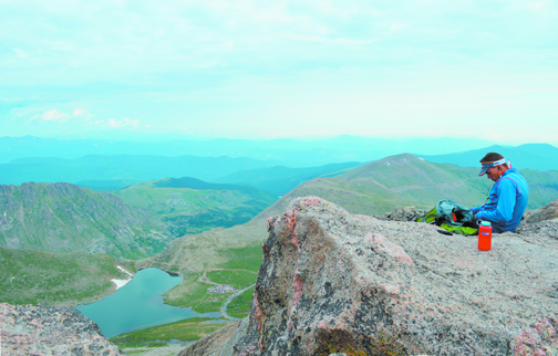
Feeling the heat? Go higher! It’s August, and although weather patterns have been less then normal recently, the high country should see some of the warmest temperatures of the year this month. When the heat is on in the mountains, the best solution is to find even higher ground to keep cool.
The mountain towns from Georgetown to Estes Park are, thankfully, at the doorstep to some of the best high-altitude destinations in the Front Range. While high country residents may not be dealing with same extreme temperatures as down in the flatlands, it is nice that an escape from the heat is needed, the solution is close at hand.
While there are countless ways to get yourself to altitude in the summer, a few of the more popular and accessible places are detailed here. Find a place you’ve never been or get inspired to look for relief some place all your own. Once you’ve gone higher, hiking, biking, climbing, sight-seeing, fishing, driving and most other activities are all more enjoyable in the crisp, cool, thin air.
GUANELLA PASS SCENIC BYWAY
The Guanella Pass Scenic Byway is a great introduction to Colorado’s Rocky Mountains. Climbing from Georgetown to above timberline, the byway takes in views of snow-capped peaks and alpine tundra before descending into cool groves of aspen and pine. This paved road climbs the steep divide between the South Platte and Clear Creek watersheds. The road crests well above timberline and is flanked by Mounts Bierstadt and Evans. Hikes to these 14ers, among other great routes, are easily accessible from the byway.
BERTHOUD PASS/CONTINENTAL DIVIDE
Berthoud Pass, reached via Hwy. 40 at 11,307 feet, features a trail head located on the Continental Divide. It offers a variety of summer activities including hiking on the Continental Divide National Scenic Trail or hike east to James Peak through the James Peak Wilderness.
MOUNT EVANS SCENIC BYWAY
The Mount Evans Scenic Byway, the highest paved road in the U.S., climbs more than 7,000 feet in 28 miles, reaching an altitude of 14,130 feet. At the summit, spectacular 360-degree views of the Continental Divide and Front Range await. This is also the best place in Colorado to catch a glimpse of mountain goats and bighorn sheep. Hiking trails, fishing lakes and other activities are also easily done. The byway can be reached via Interstate 70 exit 240 in Idaho Springs.
ST. MARY’S GLACIER
St. Mary’s Glacier is located in Alice near Idaho Springs. The community is rich in history and the hike to St. Mary’s Glacier is one of the top tourist destinations in Clear Creek County. The hike to St. Mary’s Lake, located at 10,848 feet, and St. Mary’s Glacier is about 3/4 mile and is a moderate hike over rocky terrain featuring breathtaking scenery and year-round ice field.
TRAIL RIDGE ROAD SCENIC BYWAY/ALPINE VISITOR CENTER
The Trail Ridge Road is one of only 10 “America’s Byways” and a nationally designated “All American Road.” Trail Ridge Road, Rocky Mountain National Park’s heavily traveled highway to the sky, inspired awe before the first motorist ever traveled it. Covering the 48 miles between Estes Park on the park’s east side and Grand Lake on the west, Trail Ridge Road more than lives up to its billing. Eleven miles of this high highway travel above treeline, the elevation near 11,500 feet. As it winds across the tundra’s vastness to its high point at 12,183 feet elevation, the route offers visitors thrilling views, wildlife sightings and spectacular alpine wildflower exhibitions, all from the comfort of their car. The Rocky Mountain National Park Alpine Visitor Center, offering food, drink, restrooms, souvenirs and hiking trails, is located near the road’s highest point. It is the highest facility of its kind in the National Park Service.
ARAPAHOE/ROOSEVELT NATIONAL FOREST
The Arapaho and Roosevelt National Forest encompasses 1.5 million acres and extends north to the Wyoming border, south of I-70 to Mount Evans and west across the Continental Divide to the Williams Fork area. Trails throughout the forest provide numerous access points to the high elevations. High alpine lakes abound and some of the highest mountain passes can be reached from trail heads all over the Peak the Peak and Clear Creek County regions.
JAMES PEAK WILDERNESS
The James Peak area became part of the National Wilderness Preservation System in 2002. The 17,000-acre James Peak Wilderness is located within the Arapaho and Roosevelt National Forests within Boulder, Gilpin and Clear Creek counties. Adjacent to the Continental Divide on the eastern slope, the James Peak Wilderness Area includes several peaks over 13,000 feet and more than a dozen sparkling alpine lakes.
INDIAN PEAK WILDERNESS
Indian Peaks Wilderness became part of the National Wilderness Preservation System in 1978 and spans 76,711 acres. This wilderness shares borders with James Peak Wilderness to the south and Rocky Mountain National Park to the north. Elevations range from 8,300 to just over 13,500 feet and the area includes over 50 lakes and 28 hiking trails that cover about 133 miles. Indian Peaks is one of the most visited Wilderness areas in the United States. Named for various Native American tribes, the Indian peaks top out over 13,000 feet and form a snowy and scenic backdrop to the city of Denver. Much of the terrain is steep and heavily forested.
ARAPAHOE GLACIER
Arapaho Glacier is the largest glacier in the state of Colorado and helps provide water for the city of Boulder. The Arapaho Glacier Trail leads northward from the Rainbow Lakes Trailhead and enters the Indian Peaks Wilderness. Climbing through the woods for about two miles, the trail exits onto the open tundra with a view into the Boulder Watershed. After several switchbacks, the trail crosses to the south side of the ridge. At its highest point, the trail offers a spectacular overlook of the Arapaho Glacier, 13,397-foot South Arapaho Peak, and 13,502-foot North Arapaho Peak. The trail descends 1,300 feet down a series of switchbacks to the south, intersecting the Arapaho Pass Trail at Fourth of July Mine.
BRAINARD LAKE/MOUNT AUDOBON
The Brainard Lake Recreation Area is surrounded by subalpine forest set in a glacially-carved valley. The craggy peaks of the Continental Divide provide a spectacular backdrop for visitors to enjoy. With a wide variety of year-round outdoor recreation opportunities available, Brainard Lake Recreation Area is the most popular destination on the Boulder Ranger District. Hiking trails to the west of the area enter into the Indian Peaks Wilderness. From here the 13,229-foot Mount Audubon is easily reached. It’s the sixth tallest peak in the Wilderness, and the highest with a maintained trail up to the summit.
LONGS PEAK
At 14,259 feet, Longs Peak towers above all other summits in Rocky Mountain National Park. The flat-topped monarch is seen from almost anywhere in the park. Different angles show the great mountain’s unique profiles. Changing weather reflects Longs Peak’s many moods. In the summertime, when conditions allow, thousands climb to the summit via the Keyhole Route. The Keyhole Route is not a hike. It is a climb that crosses enormous sheer vertical rock faces, often with falling rocks requiring scrambling, where an un-roped fall would likely be fatal. Enjoy the experience, but be willing to turn around at any time. For those who are prepared, Longs Peak, one of the most popular routes in Colorado, is an extraordinary climbing experience.
Do what you can to get up to altitude while you can to escape the summer heat and take advantage of areas that are only accessible a few months of the year.
